In late June, the U.S. Department of Defense announced it would cease the use of some data essential to most hurricane forecasts. Following that, NOAA distributed a notice to all users, including the National Hurricane Center, that by June 30, the agency would no longer receive real-time microwave data collected by three weather satellites jointly run by NOAA and the U.S. Department of Defense.
A June 30 update from NASA stated that the satellite feed that hurricane forecasters use to determine storm intensification has been extended. The NASA post announcing the news said that the critical data will be available until July 31, the start of the most intense period of hurricane activity in the Gulf of Mexico and the Atlantic.
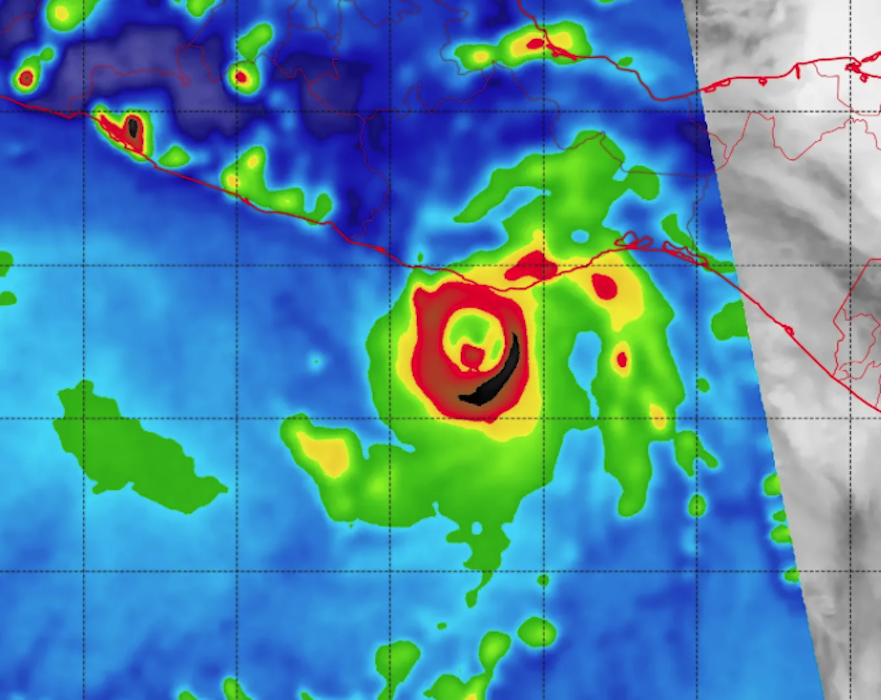
“There is critical information that we can get from these satellites that we cannot get from more traditional visible or infrared satellites,” Phil Klotzbach said in an interview. Klotzbach is a senior research scientist for the Department of Atmospheric Science in the Walter Scott Jr. College of Engineering at Colorado State University, and first author of the university’s well-respected seasonal hurricane forecasts. “Microwave imagery helps us look at the inner core of the storm, including identifying patterns in satellite imagery that can tip us off to rapid intensification.”
In a Substack article about the data stoppage, Michael Lowry, a hurricane and storm surge expert and a hurricane specialist and tropical program lead for WPLG news in Miami, said that the “permanent discontinuation of data from the Special Sensor Microwave Imager Sounder will severely impede and degrade hurricane forecasts for this season and beyond, affecting tens of millions of Americans who live along hurricane-prone shorelines.”
In his article, Lowry quotes retired National Hurricane Center branch chief James Franklin: “Without this imagery, there will be increased risk of a ‘sunrise surprise,’ the realization from first-light images that a system had become much better organized overnight, but it wasn’t recognized because structural details are so hard to discern from [infrared satellite].”
Lowry gives an excellent interpretation of the differences in quality between the satellite imagery that will be lost and what’s now available, and underscores the baseline import of the loss of data: “This means a much a higher risk of missing episodes of rapid intensification in the absence of hurricane hunters (only available for about one in every three forecasts) and less warning time for residents when a hurricane is rapidly forming or strengthening near the coast, giving those in harm’s way less time (or even no time) to prepare or evacuate.”